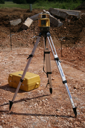
Land Surveyors
Our team of dedicated, survey professionals are an important component of the quality services we provide. Their experience and knowledge are instrumental to the efficient and cost effective development of our client’s projects. We work directly with developers, governmental agencies, industries, consultants, attorneys, and title and utility companies on a range of design and construction projects including:
Click image to enlarge.

- Roads and Highways
- Water Distribution Systems
- Wastewater Collection Systems
- Drainage and Storm Water Drains
- Land Developments
- Residential Subdivisions and Condominiums
- Underground Utilities
- Commercial and Industrial Developments
We provide the following Survey and Mapping services:
- Topographic Mapping
- Utility Mapping
- Design Surveys
- Boundary Surveying
- Land Division Surveys
- Construction Staking
- Flood Plain Surveys
- As-Built Surveys
- Volume Determinations
- Aerial Photo Control
- Horizontal and Vertical Control
- Global Positioning System Surveying
- Digital Terrain Modeling
- GIS Data Collection
- ALTA/ACSM Land Title Surveys
- Right-of-Way Surveys
We are an active participant in the Livingston County Remonumentation Program and have been a member of the County Peer Group since its inception.

